Zone Chart for USPS, and UPS & FedEx
Overview
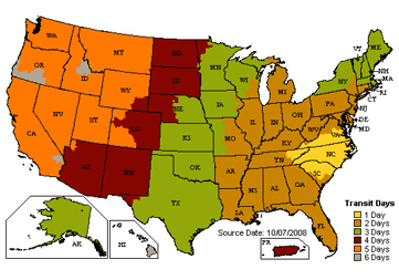
 UPS, FedEx and the United States Postal Service all use shipping zones to calculate shipping costs. The shipping zone number represents the relative distance between two zip codes, so for any two zip codes in the United States, there is a corresponding zone number. There are seven different zone numbers, 2-7. The farther two zip codes are from each other, the higher the zone number and, consequently, the higher the shipping costs. Be aware, however, that the zone number is not the only factor used in calculating cost.
For your convenience, this tool generates a zone chart for any valid U.S. zip code. You only need the first three digits of any zip code to make it work. This chart contains all of the zone numbers from any starting zip code entered. Just type the first three digits of your zip code and click the “GET ZONE CHART” button. Please Note: The zones provided by this tool are valid for USPS and, for the most part, ground shipping with UPS and FedEx. Both UPS and FedEx have different zone charts (not provided by this tool) for air shipping and for shipping to Alaska, Hawaii and Puerto Rico.